Tribes & Treaty Rights
For centuries preceding western settlement, Columbia Basin Tenino and Wyam Indians lived, fished, hunted and traded along the three rivers that border Sherman County, the Columbia, Deschutes and John Day.
The Nez Perce Tribe, the Confederated Tribes of the Umatilla Indian Reservation, the Confederated Tribes of the Warm Springs Reservation of Oregon, and the Confederated Tribes and Bands of the Yakima Indian Nation are the tribes in the Columbia Basin with 1855 Columbia River Treaty rights to anadromous fish.
Explorers & Passers-By
Early explorers reported the splendid abundance of the Pacific Northwest and by 1843 thousands of pioneers set out for the Oregon Country. Emigrants passed through what is now Sherman County in a great cloud of dust on the way to the Willamette Valley.
Settlers & Homesteaders
 The county’s first permanent white settler was William Graham, who located at the mouth of the Deschutes River in 1858. Next came innkeepers and stage station, ferry and toll bridge operators. Stockmen followed with herds of horses, cattle and sheep which ranged freely over the rolling bunchgrass hills. Jesse Eaton settled at the head of Spanish Hollow.
Homesteaders, eager for land, arrived in the 1880s by steamboat, stage and wagon; shortly, farmers settled every quarter section. The area changed almost overnight from livestock country to a farming community as settlers built homes, plowed the grass and fenced the rolling prairie in order to receive government patents.
Formation of the County
With the population growing and desiring independence from Wasco County, E. O. McCoy’s legislative bill creating a county to be called Fulton, after the pioneer Fulton family, passed in 1889. Established February 25, 1889, the new county was, however, named Sherman after General William Tecumseh Sherman of Civil War fame.
Hamlets Long-Gone
Long-gone, sometimes remembered hamlets, sites of country schools or rail sidings include Rosebush, Erskine, Bourbon, DeMoss, Rutledge, Wilcox, Gorman, Gordon, Grover, Fargher, Emigrant Springs, Early (for its early spring garden produce on the John Day River), Miller, Monkland, McDonald or McDonald's Ferry (at the John Day River Oregon Trail Crossing), Thornberry and Klondike.
Trails, Rails & Roads
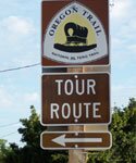
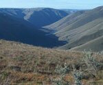
Beginning in the 1840s, Oregon pioneers passed through the northern part of the county on the Oregon Trail, from the John Day River Crossing to the crossing at the mouth of the Deschutes River. Some emigrants destined for the Barlow Road took the Cut-off to the Barlow Road a short distance west of the John Day River leading southwesterly through Grass Valley Canyon to present-day Grass Valley and down Hollenbeck Point to Buck Hollow and a dangerous crossing of the Deschutes River.
From the 1860s, a series of stage, mail and freight routes crossed the county, connecting The Dalles with Boise, Umatilla, Walla Walla and Canyon City. The Dalles Military Road, established in 1868, cut from the northwest on the Deschutes diagonally toward Shaniko in Wasco County on the south, following a route used for years by pack train operators.
Oregon Railway and Navigation Company trains roared down the Columbia from the John Day River to Celilo in 1881. This railway connected with the transcontinental line in 1883, bringing many settlers to this area.
The county’s population swelled to 4,242 in 1910, during the James J. Hill and E.H. Harriman fight to build a railroad up the Deschutes River.
Today, Interstate 84 parallels the Columbia River and old Highway 30, intersecting at Biggs with Highway 97 which traverses the full length of the county and links Sherman County to Washington State via the Sam Hill Memorial Bridge and points south.
Highway 206, crossing the county diagonally, follows Fulton Canyon from the Columbia River through Wasco to Cottonwood Grade and the John Day River, destination Condon and beyond.
Highway 216 connects Grass Valley to the juncture of Buck Hollow and the Deschutes River near Sherar’s Bridge.
The devastating flood of December 1964 ripped apart the rail line over which grain was shipped to Columbia River rail and barge facilities. Grain is trucked from the field to farm storage bins and grain cooperative elevators where it is stored until sold and shipped.
Enormous barges pushed by tugs ply the waters of the Columbia River transporting goods and fuel upriver and grain downriver for distribution.